
Adventure Travel
7 Arizona Road Trips Worth Adding to Your Travel Bucket List

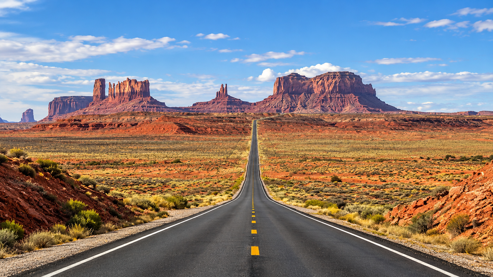
You can cross Arizona on the interstate in an afternoon and see almost none of it. The state keeps its best scenery on slower roads: a red rock byway into Sedona, a rim road above the Grand Canyon, a mountain pass on old Route 66. For some travelers, an exotic car rental Arizona trip is the whole point, with the car as much of a draw as the view.
Any reliable car handles most of these routes, though. What matters more is picking one that fits your time, your season, and your passengers. Here are seven Arizona road trips worth the miles, with what you’ll see, who each one suits, and what to know before you go.
Here are seven Arizona road trips worth the miles, with what you’ll see, who each one suits, and what to know before you go.
1. The Red Rock Scenic Byway to Sedona
About two hours north of Phoenix, State Route 179 leaves Interstate 17 and winds toward Sedona. Roughly 7.5 miles of it form the Red Rock Scenic Byway, Arizona’s first All-American Road. Bell Rock and Courthouse Butte rise beside the pavement before you even reach town.
Continue north on State Route 89A and the road follows Oak Creek through a shaded canyon, then climbs a run of switchbacks to a forest overlook. It suits first-time visitors and couples. Arrive early on weekends, when traffic into Sedona slows to a crawl, and note that many trailhead lots require a Red Rock Pass.
2. Desert View Drive at the Grand Canyon
Most visitors see the South Rim from one or two crowded viewpoints. Desert View Drive gives you 23 miles of them. The road runs east from Grand Canyon Village along the rim, with pullouts at Grandview Point, Moran Point, and Navajo Point, and it ends at the stone Desert View Watchtower, built in 1932.
This road is open to private vehicles, so families can stop as often as they like. Allow about three and a half hours from Phoenix to reach the village, and stay overnight nearby if you can. Sunrise and sunset are the reason to come.
3. Historic Route 66 From Seligman to Oatman
Route 66 turns 100 in 2026, and Arizona holds its longest unbroken stretch, about 158 miles between the Seligman area and Topock on the California line. Start in Seligman, where a local barber launched the campaign to save the old road, then roll west through Peach Springs and Hackberry to Kingman.
The final leg climbs over Sitgreaves Pass and drops into Oatman, a former gold camp where wild burros wander the main street. It’s a trip for nostalgia lovers and photographers, and no place for oversized vehicles.
4. Kayenta to Monument Valley on US 163
Monument Valley is the landscape people picture when they think of the American West. From Kayenta, US 163 runs roughly 25 miles north toward the Utah line, and the sandstone buttes grow on the horizon the whole way.
The 17-mile Valley Drive inside Monument Valley Navajo Tribal Park is a rough dirt loop, so drivers of low cars should stay at the visitor center overlook or join a Navajo-guided tour. The park charges its own entry fee and doesn’t accept national park passes. One more quirk: the Navajo Nation observes daylight saving time and the rest of Arizona doesn’t, so clocks here run an hour ahead from March to November.
5. The Catalina Highway up Mount Lemmon
Near Tucson, about two hours south of Phoenix, the Catalina Highway climbs roughly 6,000 feet in 27 miles. You start among saguaros and finish in pine forest near the village of Summerhaven, where the air can feel 20 to 30 degrees cooler than the city below.
Windy Point Vista, about halfway up, is the stop everyone remembers. This is the best summer road trip on the list. Share the road with cyclists, and check conditions in winter, when snow can close the upper section.
6. The Apache Trail to Tortilla Flat
State Route 88 starts in Apache Junction, about 35 miles east of downtown Phoenix. It twists through the Superstition Mountains past Canyon Lake to Tortilla Flat, a tiny outpost with a saloon and a general store. The paved run is about 17 miles and makes an ideal half-day drive.
Treat Tortilla Flat as the turnaround. A few miles beyond it the pavement ends, and the road past Fish Creek is primitive dirt meant for high-clearance four-wheel-drive vehicles. Monsoon storms closed that section for several days in July 2026, so check az511.gov on the morning you go.
7. The Coronado Trail Through the White Mountains
The Coronado Trail is the route most visitors have never heard of. US 191 runs about 120 miles between Clifton and Springerville in eastern Arizona, with roughly 460 curves and a high point above 9,000 feet. It passes the enormous Morenci copper mine, then climbs into forest and alpine meadows around Hannagan Meadow.
Traffic is light, and so are services. Fuel, food, and cell service are scarce between Morenci and Alpine, and some curves slow to 10 miles an hour. Allow a full day, fill the tank first, and save this one for confident drivers.
What Sitgreaves Pass Is Really Like to Drive
Here is how one of these roads feels from behind the wheel. Travelers who have driven the Route 66 climb out of Kingman describe the same sequence. First comes Cool Springs, a 1920s stone service station sitting alone in the desert. Then the road narrows and starts to climb, gaining more than 2,000 feet in about eight miles. The hairpins drop to 15 miles an hour, the shoulders disappear, and the drop-offs sit right beside your door.
Most drivers hold around 20 miles an hour and need about 45 minutes to cover those eight miles and their 191 curves. On the way down, the first burro often shows up before the town does. In Oatman they walk straight up to visitors holding bags of feed from the shops, even on days when the temperature reaches 100°F. It’s slow, a little tense, and the part of the trip people talk about afterward.
Before You Go
- Season: October through April suits the desert routes, while Mount Lemmon and the Coronado Trail are best from late spring through fall.
- Heat: Summer afternoons in the low desert pass 105°F, so start at sunrise and carry more water than you think you need.
- Monsoon: From mid-June through September, sudden storms bring dust and flash floods, and no flooded wash is safe to cross.
Matching the Car to the Road
The right vehicle makes a good route better. A convertible such as the Ferrari 488 Spider belongs on the Red Rock Scenic Byway, where the best views are overhead. A mid-engine sports car suits the curves of Mount Lemmon, and a full-size SUV is the comfortable choice for a Grand Canyon or Monument Valley trip with family and luggage. Whatever you drive, keep low cars on pavement and compare any rental’s daily mileage allowance with your route. A round trip from Phoenix to Sedona alone runs about 230 miles.
Start With One Road
You don’t need to drive all seven in one visit. Pick the route that matches your season and your schedule, and leave room for the stops you didn’t plan. Arizona’s roads have a way of putting the next one on your list before you’ve finished the first.
Frequently Asked Questions
1. What is the most scenic road trip in Arizona?
The Red Rock Scenic Byway into Sedona is the best known, and it was Arizona’s first All-American Road. Desert View Drive at the Grand Canyon and the Catalina Highway up Mount Lemmon are close rivals, each with very different scenery.
2. When is the best time for an Arizona road trip?
October through April is the most comfortable season for desert routes. In summer, choose high-elevation drives like Mount Lemmon or the Coronado Trail, and start early in the day.
3. How many days do you need for an Arizona road trip?
A single route takes half a day to a full day. To combine Sedona, the Grand Canyon, and Route 66 in one loop, plan four to five days.
4. Can you drive to Monument Valley in a regular car?
Yes. US 163 is paved all the way to the park entrance. The Valley Drive inside the park is unpaved and rough, so many visitors in standard cars book a guided tour for that part.
5. Is the Apache Trail fully open?
The paved section from Apache Junction to Tortilla Flat is open to all vehicles. Beyond Fish Creek the road is primitive and limited to high-clearance four-wheel-drive vehicles, and storms can close it without much notice.

Emma Poppy Deyes: The Inspiring Story of Poppy Deyes, Her Career, Family, and Lifestyle Brand

Laura Sherriff: The Inspiring Story of Craig Phillips’ Wife, TV Presenter and DIY Entrepreneur

Classroom 15x: The Ultimate Guide to Free Online Games, Features, Benefits, and Safe Gaming

Crackstube Explained: A Complete Guide to Its Features, Content, Safety, and Digital Publishing Platform

Nomurano: Discover the Powerful Meaning Behind Modern Creativity, Design, and Intentional Living

Instagram Video Downloader: The Ultimate Guide to Saving Instagram Videos Safely and Easily

Provascin: A Complete Guide to Its Ingredients, Potential Benefits, Uses, and Safety

Tikcotech Explained: Powerful Features, Digital Tools, Benefits, and Everything You Should Know

Cristher: A Complete Guide to Premium Outdoor Lighting, Innovative Design, and Architectural Solutions

HMJones.net Explained: A Complete Guide to Business Loans, Funding Options, and Smarter Financial Decisions
Nomurano: Discover the Powerful Meaning Behind Modern Creativity, Design, and Intentional Living
Crackstube Explained: A Complete Guide to Its Features, Content, Safety, and Digital Publishing Platform

Everest Base Camp Trek vs Manaslu Circuit Trek: Routes, Difficulty, Costs, Altitude and Mountain Experience

Mindset Energy: The Powerful Secret to Better Focus, Confidence, and Personal Growth
HMJones.net Explained: A Complete Guide to Business Loans, Funding Options, and Smarter Financial Decisions

iProwess: Discover the Innovative Audio Brand Combining Smart Sound, Lighting, and Modern Technology

Discover Europe Differently: How European Active Projects Are Reshaping Modern Travel
Provascin: A Complete Guide to Its Ingredients, Potential Benefits, Uses, and Safety

Master Information Block: The Essential Guide to Understanding 4G and 5G Network Communication
Instagram Video Downloader: The Ultimate Guide to Saving Instagram Videos Safely and Easily
Emma Poppy Deyes: The Inspiring Story of Poppy Deyes, Her Career, Family, and Lifestyle Brand
Laura Sherriff: The Inspiring Story of Craig Phillips’ Wife, TV Presenter and DIY Entrepreneur
Classroom 15x: The Ultimate Guide to Free Online Games, Features, Benefits, and Safe Gaming
Crackstube Explained: A Complete Guide to Its Features, Content, Safety, and Digital Publishing Platform
Nomurano: Discover the Powerful Meaning Behind Modern Creativity, Design, and Intentional Living
Instagram Video Downloader: The Ultimate Guide to Saving Instagram Videos Safely and Easily
Provascin: A Complete Guide to Its Ingredients, Potential Benefits, Uses, and Safety
Tikcotech Explained: Powerful Features, Digital Tools, Benefits, and Everything You Should Know
Cristher: A Complete Guide to Premium Outdoor Lighting, Innovative Design, and Architectural Solutions
HMJones.net Explained: A Complete Guide to Business Loans, Funding Options, and Smarter Financial Decisions
-
 Blog2 months ago
Beyond the Cages: How an Artificial Zoo Could Redefine Wildlife Travel
-
Technology16 hours ago
Crackstube Explained: A Complete Guide to Its Features, Content, Safety, and Digital Publishing Platform
-
Blog16 hours ago
Nomurano: Discover the Powerful Meaning Behind Modern Creativity, Design, and Intentional Living
-
Adventure Travel1 week ago
Everest Base Camp Trek vs Manaslu Circuit Trek: Routes, Difficulty, Costs, Altitude and Mountain Experience